
At a glance
- Location
- Muttom, southwest coast of Kanyakumari district
- Recommended time
- 1–2 hours; add time only if lighthouse entry is available
- Best for
- Coastal scenery, lighthouse visitors and photography from permitted viewpoints.
- Best time
- Visit the lighthouse during a published session, then leave time for the coast in softer light. Avoid exposed viewpoints during rough seas or thunderstorms.
- Entry
- The lighthouse has its own visiting sessions and ticket arrangements. Visitor information should be confirmed before travelling.
- Walking
- Keep to established paths. Rocky shore surfaces can be uneven, slippery and exposed to waves.
Before you go: Stay back from wave-washed rocks and cliff edges.
Visit durations are editorial planning suggestions. Allow extra time for travel, queues and your group’s pace.
Why visit Muttom?
- Rocky coastal scenery rather than a continuous sandy beach
- The lighthouse above the shore
- All Saints’ Church and a living fishing village
How to reach
By bus
The district lists 14D from Nagercoil Vadasery via Anna bus stand and Rajakkamangalam, and 302 from Kanniyakumari via Kovalam and Manakudy. Ask for Muttom beach or the lighthouse approach, as these need different final stops. These are official published route listings, not live service confirmations. Confirm the destination board, boarding point, final stop and return service before travel.
By train
Nagercoil Junction (NCJ) is a regional railway gateway; arrange a separate road transfer. Check your train's stopping station and travel-date timetable.
By road
Muttom is about 16 km from Nagercoil according to the district tourism page. Confirm the coastal viewpoint or lighthouse entrance before arranging the final transfer.
Official route listings checked: . Kanniyakumari District Administration: Muttom Beach.
No operator timetable, frequency, fare, exact beach stop or lighthouse walking distance verified. The Anna-stand row has a questionable combined via description, so its other route numbers were not adopted. No official nearest-station assessment established.
Visitor information
- Lighthouse timings
- DGLL lists 10:00–13:00 and 14:30–17:30; Monday holiday. Last verified: 31 October 2026. Confirm the day's access before setting out.
- Tickets and facilities
- Check the official lighthouse booking service for admission and current visitor facilities. Visitor information should be confirmed before travelling.
Best time to visit
Visit the lighthouse during a published session, then leave time for the coast in softer light. Avoid exposed viewpoints during rough seas or thunderstorms.
Confirm lighthouse admission and viewing hours before making the tower your main reason for travelling. October–March is a useful planning season, but clear skies and calm seas are never guaranteed. Keep off wet outer rocks and allow time for the return journey.
Visitor information should be confirmed before travelling. Fees, permissions, facilities and last entry are not established unless explicitly sourced below.
Facilities, parking and accessibility
Confirm toilets, drinking water, parking, step-free access and assistance with the destination. A railway or bus arrival does not establish access to the entrance; plan any final walk or transfer for your group.
What to see and do
- Begin at an established public coastal viewpoint
- Visit the lighthouse only when admission is confirmed
- Walk through the village respectfully and leave before poor light makes the approach difficult
Important things to know before visiting
Stay back from wave-washed rocks and cliff edges. No lifeguard coverage or safe swimming area has been established for this guide.
Best way to experience this place
For photographers, work from dry established viewpoints with room to retreat; a stronger wave is not a reason to move closer.
History and story behind the place
A working coast
Rock formations and open sea give Muttom a different appearance from a long sandy beach. The shore is also part of a fishing settlement, with work and community life beyond a sightseeing stop. The fishing-life story introduces that wider coastal context.
Choose public viewpoints and leave space around boats, landing areas and working equipment. A striking photograph is not a reason to cross a barrier or step onto exposed outer rocks.
Reading the lighthouse as working maritime infrastructure
The Muttom Point lighthouse is a hexagonal masonry tower painted in black and white bands. The Directorate General of Lighthouses and Lightships records its installation in 1875. As with many navigational stations, the tower, optical equipment and communications systems belong to a history of maintenance and change. The station's present identity includes NAVTEX, a maritime service through which navigation and weather information reaches vessels at sea.
The same ledger distinguishes the tower's height, 21.5 metres, from its light elevation, 42.97 metres above mean sea level. One measures the structure; the other expresses the height of the light in relation to the sea. This makes the headland itself part of the navigational story. The tower's shape and contrasting bands identify it by day, while its light serves vessels after dark. The station's NAVTEX role also places it within a continuing maritime information network.
The fishing settlement behind the view
Fishing and the parish are central to Muttom's social landscape. Boats, equipment, homes and religious buildings belong to a community whose working relationship with the sea extends far beyond a visitor's afternoon. When visible from public areas, preparation and repair can be as revealing as a landing: maintaining gear and arranging supplies show the labour behind the catch. Activity changes with season, weather and the routines of the people working there.
Christian landmarks along this part of the district's coast are living places. A church can be a point of orientation in a settlement and a centre for collective events, while the parish brings families together through a calendar of worship and celebration. That religious life sits alongside the uncertain rhythms of a maritime livelihood. Fishing communities and coastal knowledge explores the people, skills and work behind the scenery.
Muttom within the western coastal journey
Muttom belongs in an itinerary that takes the western coast seriously. Colachel introduces a historic port and the memory of the 1741 battle; Mandaikadu adds a major goddess pilgrimage; Muttom offers the rocky shoreline and a navigational station. The places share a coastal region but tell different stories. They also answer a common planning mistake: choosing western Kanyakumari does not mean choosing an exclusively inland journey of palaces, reservoirs and waterfalls.
Give the coast time of its own. A route can combine a town or shrine with an unhurried period looking at Muttom's headland rather than arriving only at the end of a long inland circuit. Changes in cloud, wind and surf are part of what makes the place interesting. The lighthouse is an optional part of that visit when public access is available; the identity of the village and shore does not depend on climbing the tower.
Two heights with different meanings
| Measurement | Value | Meaning |
|---|---|---|
| Tower height | 21.5 m | Height of the tower |
| Elevation | 42.97 m above mean sea level | Vertical position referenced to the sea-level datum |
Plan the coast on its own terms
Check public-entry arrangements with the lighthouse station before travelling specifically to go inside. Wind, waves and local restrictions can change the experience independently of the season.
Use the beach comparison to choose between a rocky viewpoint, an estuary and a sandy shore. Muttom can form part of a coastal day, but leave enough time to return before unfamiliar coastal roads become difficult to navigate.
Geography, water and local life
A shore shaped by rock, exposure and moving water
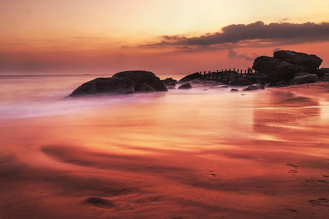
Muttom's strongest visual feature is the relationship between its rocky headland and the Arabian Sea. Outcrops interrupt the shoreline, producing short views framed by stone, surf and open water. That is a different coastal experience from a long sandy strand such as Chothavilai. Watch a sequence of waves rather than a single splash: the position of breaking water, spray and exposed rock changes continuously, making the shore feel active even when viewed from a fixed position.
Rock shapes the smaller experiences of this shore: gaps frame the moving water, wet surfaces catch the light and elevated ground opens a longer coastal view. Notice the contrast between vegetation above the salt-exposed edge and the bare stone nearest the surf. A photograph that includes the settlement or lighthouse as well as the sea helps show the scale of the headland and its place within an inhabited coast.
What makes this place unique?
The working lighthouse and rock-bound shore offer a different coastal experience from the sandy beaches elsewhere in the district.
Combine this with nearby places
Combine Muttom with Colachel on a western coastal outing. Leave time for the road between them and respect harbour access controls at Colachel.
Responsible visiting
Keep off wet outer rocks. Give fishing work and church services space; take all litter away.
Quick summary
Muttom is best for a lighthouse-and-coast visit. Allow 1–2 hours as an editorial suggestion and keep your plans responsive to sea conditions.
Sources and further reading
Sources for visitor information and transport
- DGLL: lighthouse visitor timings — Muttom Point lighthouse visiting sessions and Monday closure; not swimming safety or beach facilities.
- Kanniyakumari District Administration: Muttom Beach — 14D boarding stand and approach via Anna/Rajakkamangalam; 302 from Kanniyakumari via Kovalam/Manakudy; approximate distance from Nagercoil.
- Southern Railway: Thiruvananthapuram division station list — Station identities/codes NCJ, ERL and KZT only; not a current train timetable, last-mile distance survey or proof of nearest station.
Verification note
Editorial review: . Transport guidance follows the dated source record above; this is not a live timetable confirmation. Last verified for the explicitly sourced visitor details: 31 October 2026.
Historical references support the research passages they accompany. Editorial visit durations and recommendations are suggestions, not official operating information.