At a glance
- Best for
- Families, landscape readers and visitors interested in farming
- Start here
- Observe waterworks from permitted public places. A reservoir, canal and wetland offer different experiences; choose one main stop rather than following a channel across private land.
Before you explore
Observe waterworks from permitted public places. A reservoir, canal and wetland offer different experiences; choose one main stop rather than following a channel across private land.
Operating waterworks are not automatically visitor areas. Avoid canal edges, sluices and spillways, and confirm any dam entrance before travelling.
Visitor information should be confirmed before travelling. This article does not establish current opening hours, fees, programmes or services.
Best way to experience this
First identify whether you are looking at storage, a channel or a tank. Then look for fields, settlement and bird habitat without approaching working equipment.
Four landscapes, a Tamil way of seeing
In old Tamil literature, thinai connects nature with people's lives and feelings. Kurinji means the hills, Mullai means woods and grazing land, Marutham means farmland, and Neithal means the seashore. This is a Tamil way to understand Kanyakumari's landscapes, not an official boundary map.
Look at how the land changes from slopes to plains, trees to fields, and inland villages to the coast. What people grow, build and remember gives each place its meaning.
The district's two rainy seasons
Kanyakumari gets rain from both the southwest and northeast monsoons. Farmers grow paddy, coconut, rubber and other crops. Rain, farmland and the way water is managed support many kinds of work.
A green field is the result of work as well as rain. Farmers make decisions about seeds, water, soil and harvest. Knowing this helps us see more than just a beautiful view.
A question to ask: Where does the water for this field come from, and where does it go next?
An aqueduct tells an everyday story
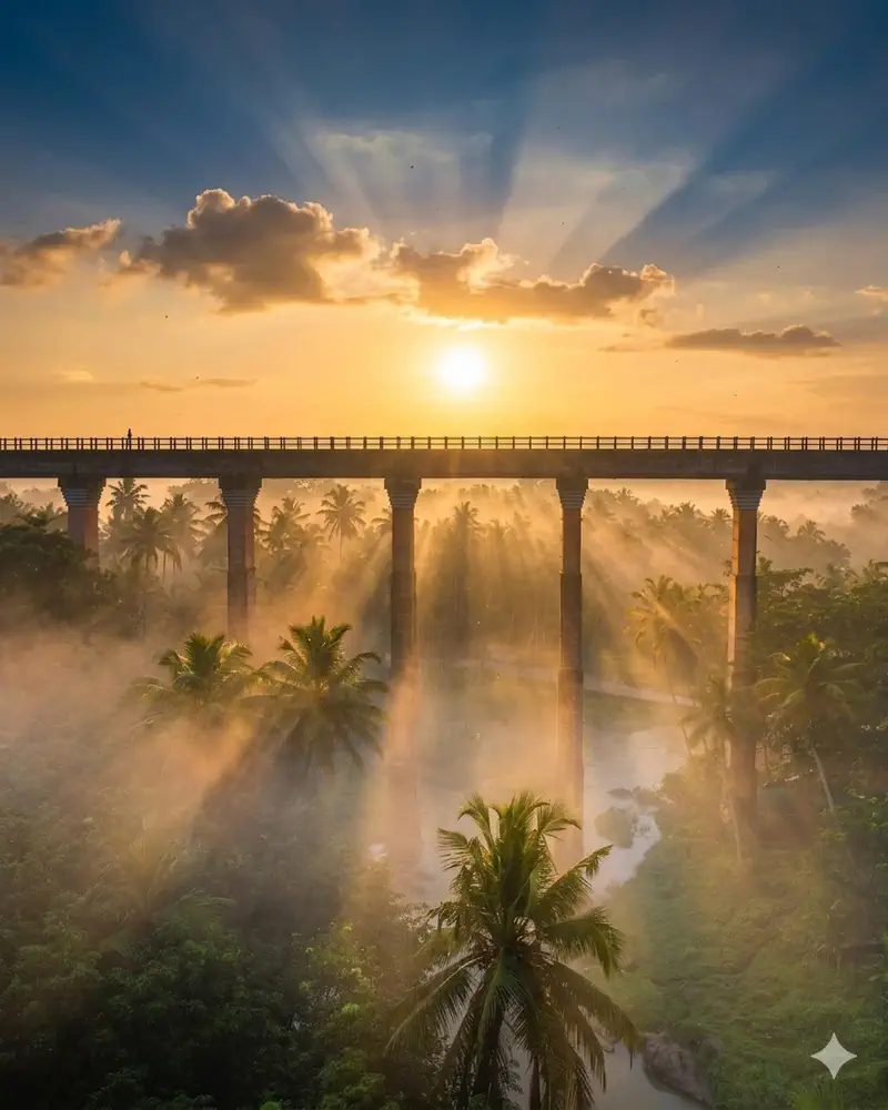
Mathur Aqueduct was built in 1966 to carry water across a valley. Its height attracts attention, but its everyday purpose is more important. It shows how engineering brings water to people and farmland.
Pechiparai Reservoir, village tanks and irrigation channels tell the same water story. Use public paths and follow local instructions while visiting them.
Bring the story into a day out
Pair a visit to Mathur with time to observe the surrounding landscape. Our Thirparappu Falls guide and personal itinerary builder introduce the inland circuit.
Keep farms and waterways as you found them. Fields are working spaces; ask before entering or photographing people at work. Notice what you can from public roads and paths.
The purpose behind a green view
A reservoir and a field do not become connected simply because they share a photograph. Distribution structures and decisions determine how water is used. The irrigation story explains that network.
The farming feature follows the crops and the people whose work makes the landscape. The result is a more complete account of green fields than a description of scenery alone.
Water storage is also habitat
The state wetlands authority describes irrigation support and ecological functions together at Suchindram Theroor and Vembannur. A tank can support cultivation while providing habitat.
The dated rainfall chart adds a measured example of a changing year. It does not predict how a field, waterfall or reservoir will look on a particular visit.
- 1Rain & catchmentWater enters the landscape.
- 2Storage & channelsInfrastructure manages part of its movement.
- 3Work & habitatCultivation and wetlands share the water story.
Follow a raindrop through the district
Rain reaching the hills can take several routes. Some enters the soil, some is taken up by vegetation and some runs into streams. Downstream storage retains part of that flow; diversion works and channels move water towards tanks and fields. At the coast, river water reaches an estuary where freshwater and tidal processes meet.
Each stage connects a natural process with human decisions. A reservoir’s release, a channel’s maintenance and a field’s irrigation turn affect where water goes next. The same water landscape supports more than a crop: tanks can provide bird habitat, and downstream communities depend on river condition. The green view is therefore the visible result of a connected system of land, water and work.
| Stage | What happens | Read more |
|---|---|---|
| Hill catchment | Rain enters soil, vegetation and streams | Forests and waterfalls |
| Reservoir | Water is stored and released | Irrigation network |
| Channel and tank | Water is distributed and retained closer to fields | Pazhayar and wetlands |
| Cultivated land | Farmers manage water for crops | Farming and produce |
| Estuary | River flow encounters tidal water and sediment | Manakudy |
What makes this part of Kanyakumari special?
A single water landscape can support cultivation, drinking-water supply and habitat, making everyday infrastructure part of the district's story.
Connect this with your visit
Mathur and Pechiparai belong to an inland water journey. Vembannur is a separate wetland outing; do not add it without allowing the road transfer.
Responsible visiting
Do not litter in channels or tanks. Keep bunds and field entrances clear for maintenance and farm work.
Quick summary
Read the green landscape through the water system that sustains it, using public viewpoints and confirmed visitor entrances.
Source and verification note
Editorial review: . This is a content review date, not confirmation of current visitor arrangements. Use the linked sources for the historical, scientific and cultural claims they support.