At a glance
- Best for
- First-time visitors choosing between coast, countryside and hills
- Start here
- Choose one landscape cluster for a short outing. Cape viewpoints, western inland heritage sites and protected hill areas have different road approaches and access rules; they cannot be treated as one walk.
Before you explore
Choose one landscape cluster for a short outing. Cape viewpoints, western inland heritage sites and protected hill areas have different road approaches and access rules; they cannot be treated as one walk.
A scenic map location does not establish public access. Check weather and permissions for the actual destination, especially in hill and river areas.
Visitor information should be confirmed before travelling. This article does not establish current opening hours, fees, programmes or services.
Best way to experience this
Notice the change from slopes to fields and then to coastal water. Stop at established public viewpoints and use the individual place guides for admission and last-mile travel.
A town and a district share a name
Kanyakumari town is the well-known place at the cape. Kanyakumari district covers a much larger area inland and along the coast. Nagercoil is its headquarters. The district covers about 1,672 square kilometres.
This is important when planning a trip. Padmanabhapuram Palace near Thuckalay, Chitharal near Marthandam and the monuments at the cape are all in the same district, but they are not close to each other.
See the district's different landscapes
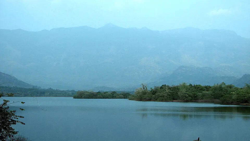
The district has paddy fields, coconut groves, rubber plantations, forests and the Western Ghats. This is why the view can change so much during a short journey.
Our four-landscape story uses the old Tamil idea of thinai to look at hills, woods, fields and the coast. It is a cultural way of seeing the land, not an official map.
Water connects the district
Kanyakumari gets rain from both the southwest and northeast monsoons. Rain fills reservoirs and supports farming, so water is part of everyday life across the district.
Water may flow from a distant hill to a field. Mathur Aqueduct is a clear example of how people move water across the land.
Look at a view in three parts: What is natural? What have people built? What work is happening there?
Use the right map
A travel map shows roads and places. A revenue map shows government areas such as taluks. A constituency map shows election boundaries. Each map has a different purpose.
Start with our places map, then read the constituency guide. Use official district maps for taluk and other government boundaries.
A district with several water landscapes
The district administration identifies Nagercoil as headquarters and gives the district area as 1,672 square kilometres. That administrative area is distinct from the area of a reservoir catchment, forest reserve or wetland designation.
Suchindram Theroor and Vembannur are separate Ramsar sites. Their areas describe designated wetlands, not the surrounding district or every channel supplying them.
Read the hills-to-sea connection
Forests, farming and the estuary are connected by water and human work. A schematic cross section makes that relationship visible without pretending to be an accurate boundary map.
Kurinji, Mullai, Marutham and Neithal provide a cultural vocabulary for reading the district. They are not four official administrative zones.
A conceptual cross section, not to scale. The four Tamil landscapes describe cultural relationships with the land.
Four Tamil landscape names and what they help you notice
The district agriculture account uses Kurinji, Mullai, Marutham and Neithal to describe the close presence of hills, wooded country, cultivation and the coast. In Tamil literary thought, landscape is connected with human life as well as terrain. The words are therefore useful for reading a journey, without drawing four fixed ecological zones on a modern map.
A slope can contain a plantation, a village can sit beside a tank, and a coastal plain can support cultivation. Those overlaps are part of the district’s geography. A traveller moving from the western hill country through the Nanjil plain to Manakudy sees connected land uses rather than a series of sealed categories.
| Name | Landscape association | A local connection |
|---|---|---|
| Kurinji | Hills | Western Ghats and their catchments |
| Mullai | Wooded and pastoral country | Forest edges and tree-covered landscapes |
| Marutham | Cultivated plains | Paddy fields, channels and settlements |
| Neithal | Coast | Fishing settlements, estuaries and the cape |
Do not join rivers just because their names look alike
Kodayar and Kothayar are spellings encountered within the same regional river-and-irrigation literature. The Paraliyar belongs to the reservoir and aqueduct story, while the Pazhayar links the Nanjil plain with Manakudy. Their names identify different courses and management relationships. The Thamirabarani name also occurs in the western Kanyakumari context; it should not automatically be read as the larger Tirunelveli river of the same name.
A useful map follows a river from its own catchment to its mouth and places dams, channels and settlements along that course. An administrative map answers another question: which district or taluk a location falls within. The irrigation guide follows the built network, while the Pazhayar story follows one river across the plain.
A sanctuary, a wetland and a district are different scales
Kanyakumari Wildlife Sanctuary covers forest habitat, while the Suchindram–Theroor and Vembannur Ramsar sites identify specific wetlands. The broader conservation-reserve designation around Suchindram–Theroor–Manakudy is another boundary. These labels can overlap, so their areas should not be added as if they were separate pieces of the district.
That distinction matters on a travel map too. A public road near a protected landscape is not evidence that the interior is open for independent walking. Read the place’s own access information and use the appropriate map for the question: route, habitat, revenue boundary or conservation designation.
What makes this part of Kanyakumari special?
The district makes the relationship between Western Ghats catchments, irrigated farming and a coast facing different seas unusually easy to understand within a regional journey.
Connect this with your visit
These guides illustrate three different landscapes. Choose the cape and Manakudy for a coastal day, or Mathur for a separate inland journey.
Responsible visiting
Stay on public approaches, leave fields undisturbed and avoid stopping vehicles where they obstruct village roads.
Quick summary
Start with the landscape you want to experience, then build a manageable route around destinations with confirmed access.
Source and verification note
Editorial review: . This is a content review date, not confirmation of current visitor arrangements. Use the linked sources for the historical, scientific and cultural claims they support.