
At a glance
- Location
- Vattakottai, coastal approach north of Kanyakumari town
- Recommended time
- 45–90 minutes
- Best for
- Families, coastal views and visitors interested in Travancore's military landscape.
- Best time
- Choose a cooler part of the published visiting period. Bring sun protection and avoid exposed ramparts during lightning or strong wind.
- Entry
- Check the current monument ticket and entry arrangements. Visitor information should be confirmed before travelling.
- Walking
- Expect a fort walk with changes of level and exposed edges; keep children close on ramparts.
Before you go: A scenic shore is not evidence of safe bathing.
Visit durations are editorial planning suggestions. Allow extra time for travel, queues and your group’s pace.
Why visit Vattakottai Fort?
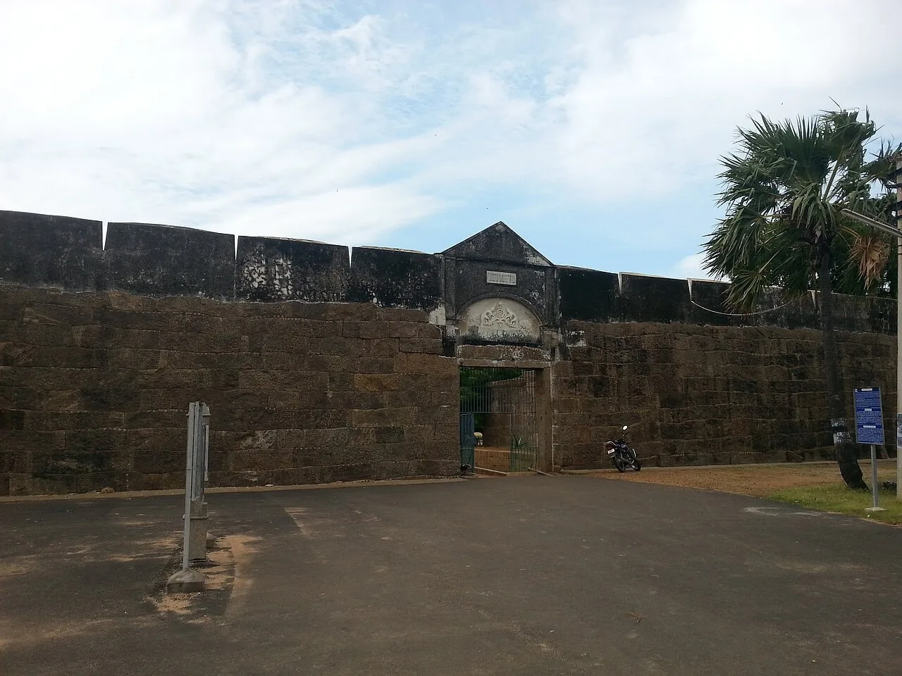
- Granite ramparts and coastal bastions
- The contrast between seaward and inland views
- The central water feature and the fort’s defensive layout
How to reach
By bus
The district fort page lists 1A, 1C, 1E and 2C from Nagercoil's Vadasery and Anna stands via Suchindram. Its Kanniyakumari terminal row also lists services via Vivekanandapuram and Mathavapuram, but the row has inconsistent separators. Confirm a bus serving the Vattakottai approach and arrange the final transfer to the fort.
By train
Kanniyakumari (CAPE) and Nagercoil Junction (NCJ) are regional railway gateways. Continue by road to the fort. A measured nearest-station comparison was not established.
By road
Use Vattakottai Fort as the full road destination. A through bus on the coastal approach does not establish a stop at the entrance; confirm the final drop-off and return transport.
Official route listings checked: . District administration: Vattakottai.
Checked the official web listing on 31 October 2026. This confirms what the authority publishes, not live operation. No departure times, frequency, fare or guaranteed return service verified. Confirm the destination, alighting stop and return service with bus staff. The source's Kanniyakumari route string is not normalised into extra route numbers here; no doorway bus access is claimed.
Visitor information
- Published timings
- The Ministry of Tourism lists 08:00–16:30. Last verified: 31 October 2026. Confirm last entry and any conservation closure locally.
- Fees and photography
- A current monument tariff and camera policy have not been established. Visitor information should be confirmed before travelling.
Best time to visit
Choose a cooler part of the published visiting period. Bring sun protection and avoid exposed ramparts during lightning or strong wind.
Choose daylight for uneven stone steps and exposed ramparts. Check admission, last entry and camera charges before travelling. Beach access and access to the protected fort are separate questions; follow the notices for each area.
Visitor information should be confirmed before travelling. Fees, permissions, facilities and last entry are not established unless explicitly sourced below.
Facilities, parking and accessibility
Confirm toilets, drinking water, parking, step-free access and assistance with the destination. A railway or bus arrival does not establish access to the entrance; plan any final walk or transfer for your group.
What to see and do
- Walk the admitted courtyard route
- Look at the wall geometry and bastions
- Pause at a permitted sea viewpoint before returning to town
Important things to know before visiting
A scenic shore is not evidence of safe bathing. Stay within permitted fort areas and do not climb parapets or cross barriers.
Best way to experience this place
For families, explore the open interior first and finish at a permitted sea viewpoint, keeping clear of the rampart edge.
History and story behind the place
A fort understood from both sides of its walls
Vattakottai's coastal position is the key to reading it. From the enclosure, the horizon and the shoreline become part of the monument; from outside, the walls mark a built edge within the open coastal landscape. A defensive site needed to observe approaches and control movement, so the relationship between ground level, elevated wall walks and the view deserves as much attention as individual stone details. Walk slowly enough to understand how the spaces relate to each other.
The Tamil name is commonly translated as circular fort, but a name should not replace looking at the actual plan. Follow the changes of direction in the enclosure and compare the wall facing the sea with the side from which visitors approach. This turns the visit into an exercise in reading a building. It also avoids the imaginative siege scenarios found in some retellings, where every opening or bend is assigned a dramatic military function without a survey to support it.
The Travancore story beyond a single coastal outpost
Vattakottai belongs to Travancore's eighteenth-century military landscape. The Ministry of Tourism places the fort in the time of Marthanda Varma and describes its granite and stone construction. Nearby Padmanabhapuram represents royal administration and residence, Udayagiri carries the memory of De Lannoy's service, and Colachel marks the conflict of 1741. The coast and the inland political centre were connected by the movement of people, supplies and military power.
At the fort itself, thick walls and raised positions bring the sea within a defensive field of view. The pond inside the enclosure adds a quieter element to the visit and reminds the observer that a garrison needed everyday infrastructure as well as a strong perimeter. Looking from the interior towards the coast and then inland places the masonry within its regional setting: the fort was built at an interface between sea approaches and the land behind them.
Looking at stonework, space and the coastal setting
Start at the entrance and notice how the fort changes the experience of the landscape. The walls compress the view on arrival; raised positions open it again towards sea and land. Differences in the size of stones, joints, repaired surfaces and changes of level can reveal the building's material character. They do not, on their own, identify a mason, ruler or century. The same disciplined looking works at Eraniel and Thirunandikkara, where surviving fabric also carries several kinds of history.
The adjoining beach adds a second subject. Dark and pale bands of sand can change with wave sorting and the movement of sediment, so the shore seen on one visit may differ from another. Kanyakumari's heavy-mineral sands are a broader coastal research topic; a black patch at a particular point is not a laboratory identification of its minerals. The coastal landscape guide follows that distinction between what is visible and what needs geological analysis.
Why the protected boundary matters
The National Monuments Authority's official list includes Vattakottai Fort and adjoining protected survey plots under the Archaeological Survey of India. The protection is therefore more than a label for the most photogenic wall. Associated land contributes to the monument's setting and to the archaeological evidence around it. Reading a fort includes the relationship between its masonry, its ground and the view; altering one can change the understanding of the others.
The accessible enclosure, its stonework and the coastal outlook offer a complete subject for exploration. Pause at the pond, follow the changing line of the walls and compare the inward-facing spaces with the view beyond them. The contrast is the fort's strongest architectural experience. For a different coastal setting later in the trip, Muttom shows how a rocky fishing settlement and a working lighthouse create another relationship with the sea.
What a coastal defensive position needed to see
A coastal fort links its perimeter with approaches from both land and sea. At Vattakottai, use the entrance, wall line and raised outlooks to understand those relationships. A broad sea view is part of the place’s defensive logic, while the enclosed ground allowed movement and activity behind the boundary. The same wall can be read as a mass of stone from outside and as the edge of a working space from within.
The name is often translated as ‘circular fort’, but a translated name should not substitute for examining the actual plan. Likewise, an attractive story about a tunnel is not evidence of a documented passage to Padmanabhapuram. The stronger regional connection is historical: the coastal outpost, Udayagiri’s inland military enclosure and the royal centre belonged to a broader Travancore landscape, each serving a different purpose.
Geography, water and local life
Dark sands and the minerals recorded at Vattakottai
The 2001 district census handbook specifically identifies heavy-mineral beach deposits at Vattakottai, Manavalakurichi and Midalam. Its list includes ilmenite, rutile, garnet, monazite and zircon. This is location-specific evidence for discussing the shore?s mineral setting alongside the fort?s military history.
The record does not mean the entire beach is uniformly black, or establish the composition of every dark patch seen today. Sand appearance alone cannot identify a mineral or measure radiation. Read the shore through its changing surface and the documented regional geology, without treating a colour in a photograph as a laboratory result.
Visiting the fort and shore
Use authorised paths and observe site notices. The shore below is a separate environment; the appearance of calm water is not evidence that entering it is safe. Current hours and ticket arrangements should be checked with the site authority.
Pair the fort with a cape visit or another coastal stop. The coastal comparison helps choose the kind of shoreline you want to see without turning every beach into a swimming recommendation.
What makes this place unique?
The fort lets visitors read coastal defence through the relationship between stone walls, open ground and the sea.
Combine this with nearby places
Combine Vattakottai with the mainland cape landmarks. Add the Rock Memorial only if the ferry queue and weather leave enough time.
Responsible visiting
Keep off restricted walls and do not collect mineral sands. A quieter-looking shore is not proof of safe wading.
Quick summary
Vattakottai suits a short fort-and-coast visit. Allow 45–90 minutes as an editorial suggestion and check the day's monument access.
Sources and further reading
- Kanniyakumari District: Vattakottai
- National Monuments Authority: list of centrally protected ASI monuments, PDF page 67
- Ministry of Tourism: Udayagiri and the wider Travancore military context
- Ministry of Tourism: Vattakottai Fort, eighteenth-century construction and pond
- Census of India: Kanniyakumari district handbook 2001, mineral resources
Sources for visitor information and transport
- Ministry of Tourism: Vattakottai Fort — Coastal fort, ramparts, pond and published 08:00–16:30 visiting hours; unsupported tunnel claims are excluded.
- District administration: Vattakottai — Published Nagercoil route list and approach via Suchindram; the cape-terminal route string is ambiguously punctuated.
- Southern Railway: Trivandrum Division station list (1 April 2022) — Station identities and codes only: Nagercoil Junction (NCJ), Nagercoil Town (NJT), Kanniyakumari (CAPE); not a current timetable or proof of the nearest station to each attraction.
Verification note
Editorial review: . Transport guidance follows the dated source record above; this is not a live timetable confirmation. Last verified for the explicitly sourced visitor details: 31 October 2026.
Historical references support the research passages they accompany. Editorial visit durations and recommendations are suggestions, not official operating information.